INTRODUCTION
The loʻi paʻakai (salt beds) of Hanapēpē (Salt Pond) is located on the west side of Kaua‘i in the Kona moku, the ahupuaʻa of Hanapēpē, and the ʻili of ʻUkula. For generations Hawaiian families have been harvesting salt at Salt Pond through an intricate system that involves puna (wells), waikū (secondary wells) and loʻi (salt beds) within the low-lying volcanic clay area mauka of Salt Pond Beach Park, and separated from the ocean by a sand berm. The Hawaiian cultural practice of making salt is one of Hawai‘i’s oldest traditions and Hanapēpē is one of the last places in all of Hawaiʻi that continues this tradition following these methods. The area and practice is highly treasured and protected by the salt makers as well as the larger community. Over the years this cultural practice has been threatened by a myriad of factors including user conflicts, nonpoint-source pollution, and wave inundation and flooding. The latter issue is the focus of this study.
Fresh and marine water can enter the pond through the following inputs: Rain, surface runoff, groundwater discharge, ocean water topping of the beach berm, and ocean water subsurface discharge (Figure 3).
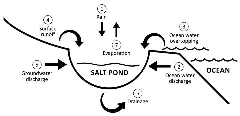
Figure 3. A simplified diagram of the water inputs and outputs two and from Salt Pond.
Dry, hot conditions are ideal for salt production, which gives the salt water enough time to evaporate in the lo`i, undiluted by rainfall or ocean flooding. The process involves the harvesting of underground seawater, accessed through puna and waikū (wells). This is then transferred to shallow salt beds or lo`i for evaporation. In recent years, Salt Pond has experienced frequent flooding from marine and terrestrial sources, impacting the culturally significant salt making practice. According to paʻakai practitioners and observers of the area, the ponds typically flood by rainwater in the winter with a dry salt making season in the summer. In recent years, however, the summer salt making season has been cut short due to marine wave overtopping, and subsurface marine flooding of the punas (wells), combined with rainwater flooding. Typically after such a flood event, the pond takes several weeks to drain. The purpose of this hydrological investigation was to better understand the subsurface structure and drainage conditions to inform future mitigation efforts and adaptation strategies.
The rate of global sea-level rise (SLR) is projected to accelerate throughout this century posing an ongoing major threat to this cultural resource through increased vulnerability to coastal inundation and flood hazards. SLR is expected to increase the frequency and severity of wave inundation, erosion, and passive flooding at Salt Pond. It will not only manifest itself in surface inundation from waves, but also subsurface intrusion, exacerbating existing drainage problems such as those already occurring at Salt Pond. According to some salt practitioners the wells do overflow and flood the surrounding area from time to time. As sea levels continue to rise this will likely become more frequent, and it will be increasingly difficult to continue making salt without adaptation or improvements.
The Hui Hāna Paʻakai o Hanapēpē (Hui) formed in 1964, and is comprised of 22 families that make salt. These families work together within the Hui to make decisions geared at preserving this long-term practice that is passed down generation by generation. Any work, research, or management effort at Salt Pond is coordinated through the Hui. This hydrological assessment was designed and implemented with Hui involvement from the onset and benefited from its extensive knowledge of the environment, area, and practice that have been shared with Hui families for generations.
Throughout 2018-2022 the University of Hawai‘i Sea Grant College Program Kaua‘i Coastal Land Use Extension Agent worked with the Hui, University of Hawai‘i scientists, and the Hawaiʻinūiakea School of Hawaiian Knowledge Hui ʻAina Momona, to conduct a hydrogeologic investigation at Salt Pond. The study, funded by the County of Kaua‘i, was geared toward determining the subsurface geomorphology and developing a groundwater model based on environmental monitoring data and the use of state-of-the-art hydro- geophysical techniques to provide:
- A water budget for Salt Pond that measures inflows, outflows, and storage to characterize the overall system.
- An evaluation of the relative magnitudes of surface flows versus subsurface flows to help determine the dominant source of flows to the pond.
- An assessment of causes for flooding (inflows vs. outflows) and causes for slow drainage to determine potential mitigation actions.
- Characterization of coastal processes that reveal the influence from marine wave overtopping of the beach and include projections of future conditions under various sea level rise (SLR) scenarios.
- Recommended mitigation actions and adaptation strategies designed to address the long term success of salt harvesting in the area.
The following activities were also conducted:
- Conducted outreach meetings with the Hui Hāna Paʻakai o Hanapēpē to gain insight into the flooding problem and to ensure their concerns are met through presentations, interviews, and engagement through indigenous scientific methodologies.
- Trained interested Hui members in water level data collection and geochemical and geophysical research techniques.
The hydrogeological investigation encompassed the bulk of this project. It involved water level analysis by Dr. Brian Glazer, water balance analysis from geochemical tracers by Dr. Henrietta Dulai, hydrogeophysics by Dr. Dulai and Drs. Nicole Lautze and Erin Wallin, and the building of a hydrologic model by Dr. Aly El-Kadi.
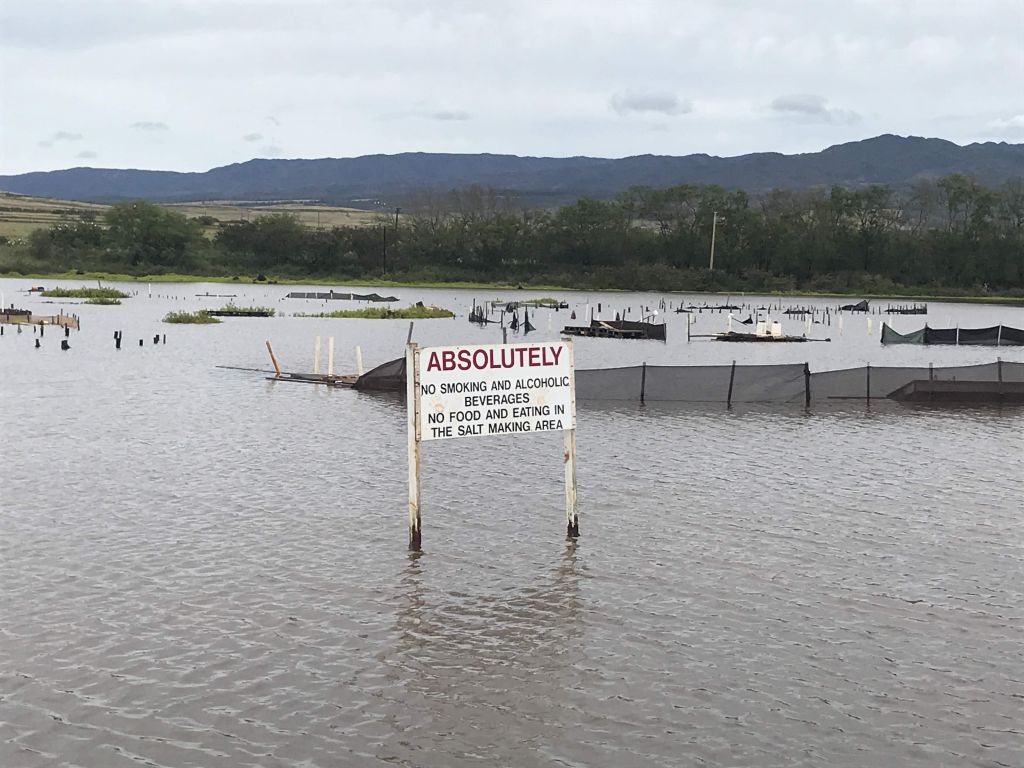
Figure 4a. Photo of Salt Pond flooded from a rainfall flooding event in March 2020.

Figure 4b. Photo of Salt Pond flooded from wave overtopping June 23, 2017.
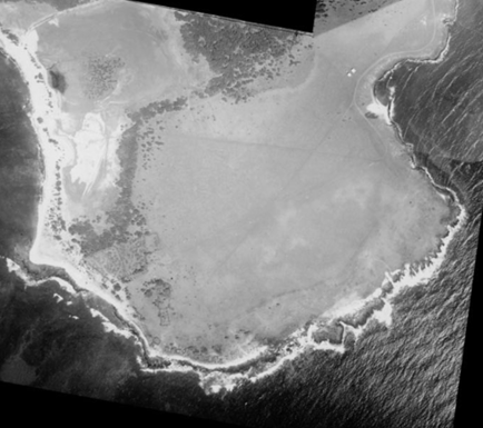
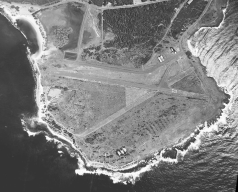
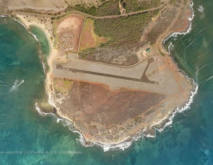
Figure 5. Historical photos of Pu`olo Point and Salt Pond from 1928, 1964, and 2021/2022. Source: University of Hawai‘i School of Ocean and Earth Sciences and Technology, Climate Resilience Collaborative; and Pictometry.
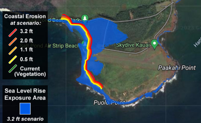
Figure 6. Salt Pond sea level rise exposure area with 3.2 feet of sea level rise, which is expected during the latter half of this century. Coastal erosion scenarios from today to 3.2 feet of SLR shows the expected changes in beach width over time. Source: PacIOOS; hawaiilealevelriseviewer.org.
REPORT AUTHORS
Ruby Pap
Principal Investigator
Coastal Land Use Extension Specialist
University of Hawaiʻi Sea Grant College Program
School of Ocean Earth Science and Technology
University of Hawaiʻi at Mānoa
Darren T. Lerner
Co-Investigator
Director
University of Hawaiʻi Sea Grant College Program
School of Ocean Earth Science and Technology
University of Hawaiʻi at Mānoa
Malia Nobrega-Olivera
Co-Investigator
Director of Strategic Partnerships
& Community Engagement
Hawaiʻinuiākea School of Hawaiian Knowledge
University of Hawaiʻi at Mānoa
Henrietta Dulai
Professor
Department of Earth Sciences
School of Ocean Earth Science and Technology
University of Hawaiʻi at Mānoa
Aly I. El-Kady
Professor Emeritus
Department of Earth Sciences
University of Hawaiʻi at Mānoa
Nicole Lautze
Director
Hawaiʻi Groundwater and Geothermal Resources Center
University of Hawaiʻi at Mānoa
Erin Wallin
Geophysical Research Scientist
Hawaiʻi Groundwater and Geothermal Resources Center
University of Hawaiʻi at Mānoa
Colin Ferguson
Graduate Assistant
Department of Geology and Geophysics
University of Hawaiʻi at Mānoa
Xavier de Bolós
Postdoctoral Researcher
Hawaiʻi Institute of Geophysics and Planetology
University of Hawaiʻi at Mānoa
Brian Glazer
Associate Professor
Department of Oceanography
School of Ocean Earth Science and Technology
University of Hawaiʻi at Mānoa
Shellie Habel
Coastal Geologist/Hydrologist
University of Hawaiʻi Sea Grant College Program
University of Hawaiʻi Climate Resilience Collaborative
School of Ocean Earth Science and Technology
University of Hawaiʻi at Mānoa
REPORT ACKNOWLDGEMENTS
PREPARED FOR AND FUNDED BY:
County of Kauaʻi Public Access, Open Space & Natural Resources Preservation Fund Commission.
SUGGESTED CITATION:
Pap, R., Lerner, D., Nobrega-Olivera, M., Dulai, H., El-Kady, A., Lautze, N., Wallin, E., de Bolós, X., Ferguson, C., Glazer, B., and Habel, S. August 2023. “Salt Pond Hydrogeologic Investigation.” Prepared by the University of Hawaiʻi Sea Grant College Program for the County of Kauaʻi Public Access, Open Space & Natural Resources Preservation Fund Commission.
Publication of this report was funded by the County of Kauaʻi Public Access, Open Space & Natural Resources Preservation Fund Commission. This study would not have been possible without the consent, knowledge, and assistance of the Hui Hāna Paʻakai o Hanapēpē. A very special mahalo goes to the Kilauano ʻohana, Peleke Flores and Victor Nobrega-Olivera for their hard work and generosity throughout the project. Lastly, thank you to Mattox Telwar and Panupong Kongpet from the Hawaiʻi Groundwater and Geothermal Resources Center for their SP fieldwork in the hot Hanapēpē sun!


