WATER LEVEL MONITORING
Methodology
To identify present hydrodynamic conditions seven real-time water level sensors were deployed at Salt Pond on August 20, 2021 that monitor water level heights in six-minute intervals. In addition to providing data in near-real-time, seasonal or episodic effects on hydrodynamics of the site were observed and described below.
The intent of deploying the water level sensors were to track changes in water level due to meteorological disturbances, tidal forcing, inundation during flooding events, and receding waters following flood events. Time-series data from individual sensors were used across the larger study, and utilized in subsections throughout the report.
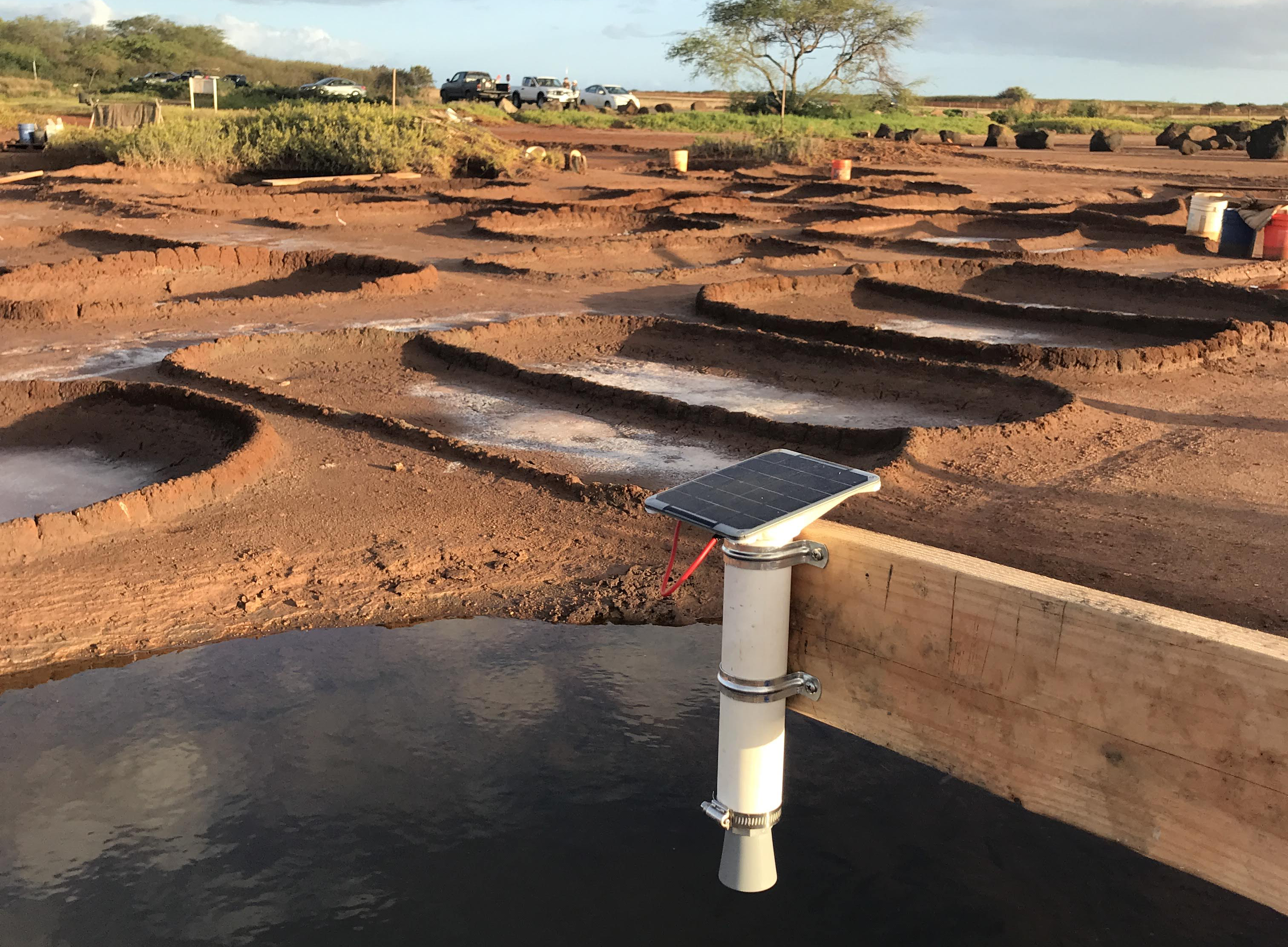
Water level sensors were mounted on fixed structures above the water surface. They measure the distance from the sensor to the water surface by measuring the time-of-flight of ultrasound (ping, then listen for echo). This variable is named d2w (“distance to water”). Because the mount height is fixed relative to the bottom of the pond, water depth can be inferred by subtracting depth to water from the height of the sensor off the sediment surface (Figure 7).
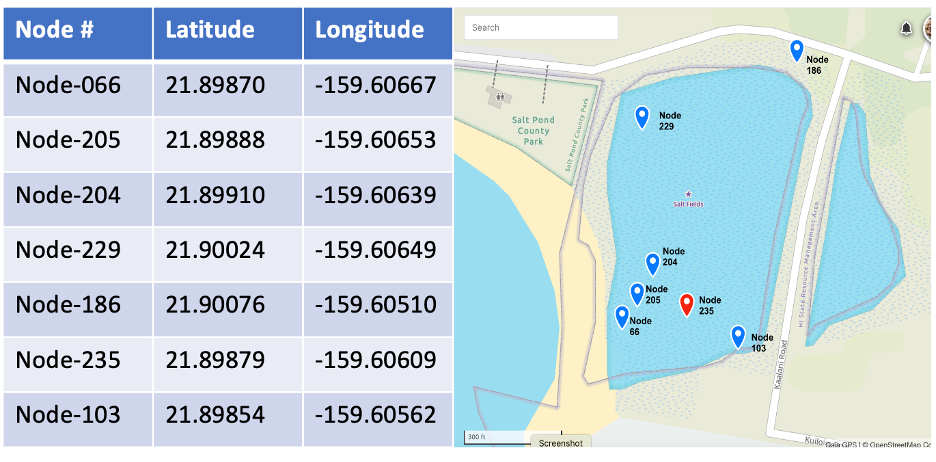
Water level sensors were deployed at priority sites of interest throughout the Hanapēpē Salt Pond area on August 20, 2021. These sites were determined by the Hui based on proximity to prior flooding, various pond characteristics (e.g. topography, puna locations, pond edge, salt making concentrated area), and proximity to known runoff areas. Data from these sensors was used to validate and ground truth findings in the following sections.

Figure 7. Photo of water level sensor deployed over a puna (dug well).

Figure 8. Image of individual water level sensor locations in Salt Pond, which were installed on site by Hui members, in consultation with UH researchers. Specific installation locations were selected for highest priority locations, as determined through consultation between Hui members and UH researchers. More information on sensor sites and installations are available in Appexdix 1 and at: https://www.gaiagps.com/public/RcYcxuc1cuHNDw2J2rqlXGzF/?layer=GaiaTopoRasterMeters.


