An architect’s toolkit: Thinking of the big picture of Waikīkī and future sea-level rise
by Ireland R. Castillo
As a budding architect, my tools of preference include some paper, pencils, pens of varying thicknesses, and the most high-tech tool, my ipad which condenses all the previous tools into one. But, even more important than any of these tools, architects have to begin with the right information. If you have wondered how communities are planned, cities are organized, or ideas of buildings develop, I can guarantee the process always starts with some paper, a pen, and the need to solve a problem like sea-level rise.
Currently, my research as a Hawaiʻi Sea Grant Graduate Fellow is about helping people envision what Waikīkī and its buildings, parks, and beaches could look like with sea-level rise, the natural accelerating process of relative ocean levels rising due to multiple factors including climate change. Our vision for Waikīkī is not a passive one; we are not describing a future where sea-level rise displaces all the residents, visitors, and businesses in Waikīkī. Rather, our goal is to help people envision how a building can be designed differently to adapt to rising sea levels and survive the inundation.
However, before grabbing our pencils and paper to design what Waikīkī could look like in the future, it was important for my partner and me to understand what other coastal cities are doing to protect their buildings and shorelines against sea-level rise. Therefore, we sifted through numerous adaptation strategies and design guidelines enforced by other cities to service similar strategies applicable to Waikīkī. Yet again, before reaching out for our pens to start sketching, we hosted multiple outreach meetings with various Waikīkī stakeholders as a way to encourage discussion and feedback on those strategies. At this point, with both the knowledge of what other cities have done and what feedback we received from our outreach meetings, my partner and I were ready with our pencils sharpened.
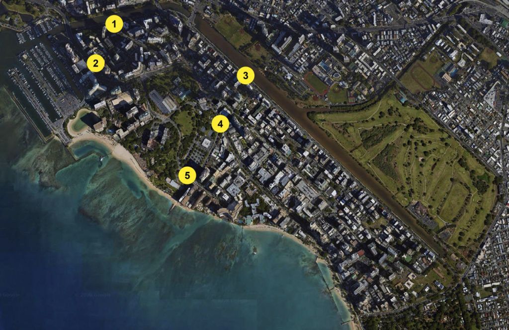
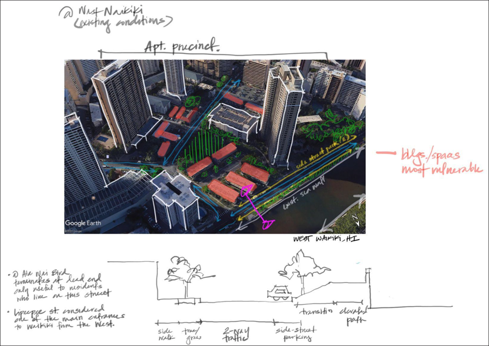
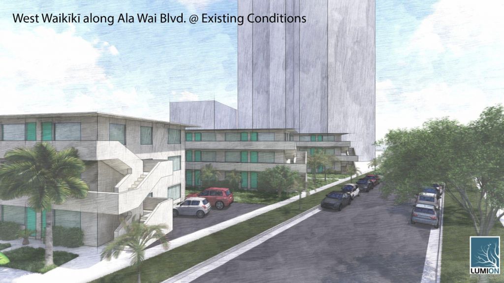
So far, we have identified five study areas (Fig. 2). In areas of West Waikīkī (e.g., points 1 and 2), our early sketches and renderings show the need to raise Ala Wai Boulevard above current elevations, in order to avoid inundation and flooding due to sea-level rise. In addition, our sketches try to incorporate ways that traffic lanes may be changed in the future to facilitate greater use of pedestrian walkways and sidewalks. Despite our primary concern with sea-level rise, our ideas about a future Waikīkī also incorporate other climate-conscious solutions like providing more trees along sidewalks in West Waikīkī along Ala Moana Boulevard to provide urban shade. These solutions are ideas that we draw, review, and discuss as a team each week.
The process of sketching and drawing is an iterative process, which we, as architects, accept. Architects are responsible for keeping the balance between the science (in this case, sea-level rise) and the graphic representation of an idea. Our sketches and renderings are meant to evoke a response from our viewers that helps them realize both the problem and possible solution. In our case, my partner and I are helping people envision a future, resilient Waikīkī, adapted to sea-level rise. For us, this is an ongoing process!

 About the author:
Ireland Castillo is a student in the UH Mānoa School of Architecture’s Doctorate of Architecture program and will be graduating in Spring 2022. She received her BA in Architectural Design from the University of Washington before returning home to Hawaiʻi, and she considers both Hawai‘i and Seattle close to her heart!