Evaluating the resilience of productive rocky intertidal ecosystems to sea-level rise using a community-based approach
PRINCIPAL INVESTIGATOR: Haunani Kane
Co-INVESTIGATORS: Atsuko Fukunaga, John Burns, Kainalu Steward
PI-CASC Graduate Scholar:
Research Track: Island Resilience and Sustainability
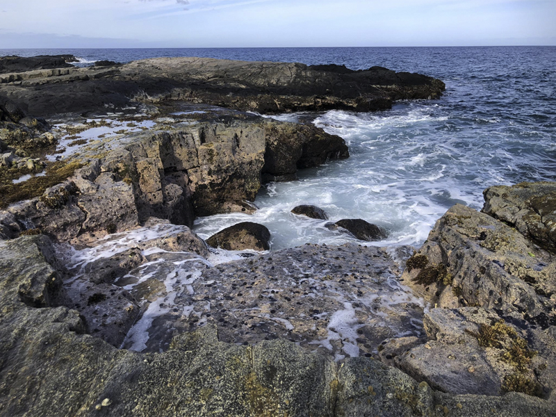
Healthy and productive intertidal ecosystems support cultural identity through subsistence gathering and restoration of traditional food types such as ʻopihi (endemic Hawaiian limpet), and limu (seaweed). Sea-level rise threatens habitat loss of traditional food types within the rocky intertidal system due to unique ecological characteristics adapted specifically to the local tidal gradient. Working in collaboration with Native Hawaiian community non-profit organization Nā Maka Onaona, the researcher team will co-develop products and management tools to improve understanding of the resilience of healthy and productive intertidal ecosystems in the face of future sea-level rise. Beyond using current suitable rocky intertidal habitat metrics to characterize seasonal changes in ʻopihi and limu abundance, the project will also examine potential migration of these habitats and their productivity with elevated sea levels.
The research team anticipates three main outcomes that will directly benefit the collaborating organization, Nā Maka Onaona, as well as intertidal resource managers and community members. First, increased research capacity and development of additional survey methods to monitor intertidal resources will support the mission and purpose of Nā Maka Onaona. Appropriate data and analyses provided to Nā Maka Onaona and the Kaʻūpulehu Marine Life Advisory Committee will help guide them in future management of Kalaemanō Reserve with future conditions of sea-level rise. Finally, they will also develop educational outreach products, including a 3-5 minute project video, 3D models of intertidal habitat to be displayed in the MEGA Lab AR App, and educational signage that will be used to guide visitors along the Kalaemanō interpretive coastal trail.